Property Record
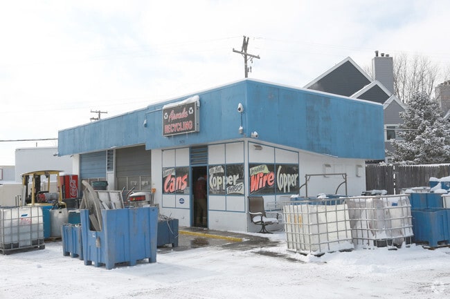
9630 Ralston Rd, Arvada, CO 80004


Property Detail
9630 Ralston Rd
Denver-Aurora-Centennial, CO
SECTION 10 TOWNSHIP 03 RANGE 69 QTR SW SUBDIVISIONCD 625605 SUBDIVISIONNAME RALSTON MINOR SUB BLOCK LOT 0003 SIZE: 16287 TRACT VALUE: .374
39-103-06-014
JEFFERSON
Commercialnec
Colorado
B and X Area of moderate flood hazard, usually the area between the limits of the 100-year and 500-year floods.
3
2025
0.37 AC
2025
Northwest Denver
010307
Denver
988 SF
NEARBY LISTINGS FOR SALE OR LEASE
DEMOGRAPHICS near 9630 Ralston Rd
1 mile
3 mile
5 mile
2025 Total Population
17,178
105,806
278,368
2030 Population
17,202
105,378
279,176
Pop Growth 2025-2030
+ 0.14%
(0.40%)
+ 0.29%
Average Age
41
42
41
2025 Total Households
7,329
44,305
115,986
HH Growth 2025-2030
+ 0.07%
(0.42%)
+ 0.27%
Median Household Inc
$93,208
$97,401
$98,726
Avg Household Size
2.30
2.30
2.30
2025 Avg HH Vehicles
2.00
2.00
2.00
Median Home Value
$659,194
$672,055
$678,867
Median Year Built
1968
1973
1974
Nearby Places
Map Layers
Map Styles
 Street
 Aerial
Transit
 Traffic
 Biking
Places
Listings with unknown addresses are not visible on the map
- Restaurants
- Banks
- Shops
- Fitness
- Groceries
PUBLIC TRANSPORTATION
AIRPORT
Denver International
Drive
Walk
Distance
Denver International
40 min
30.5 mi
Nearby Properties
Address
Land Use
TOTAL SIZE
Lot Size
Zoning
Address
Land Use
TOTAL SIZE
Lot Size
Zoning
80,030 SF
2.25 AC
Address
Land Use
TOTAL SIZE
Lot Size
Zoning
103,174 SF
1.23 AC
Address
Land Use
TOTAL SIZE
Lot Size
Zoning
93,699 SF
1.89 AC
Address
Land Use
TOTAL SIZE
Lot Size
Zoning
97,944 SF
6.34 AC
Address
Land Use
TOTAL SIZE
Lot Size
Zoning
56,854 SF
1.83 AC
Address
Land Use
TOTAL SIZE
Lot Size
Zoning
52,194 SF
5.33 AC
Address
Land Use
TOTAL SIZE
Lot Size
Zoning
72,252 SF
4.20 AC
Address
Land Use
TOTAL SIZE
Lot Size
Zoning
49,337 SF
4.02 AC
Address
Land Use
TOTAL SIZE
Lot Size
Zoning
51,612 SF
1.76 AC
Address
Land Use
TOTAL SIZE
Lot Size
Zoning
50,490 SF
1.58 AC
Address
Land Use
TOTAL SIZE
Lot Size
Zoning
72,630 SF
5.08 AC
Address
Land Use
TOTAL SIZE
Lot Size
Zoning
298,366 SF
24.21 AC
Address
Land Use
TOTAL SIZE
Lot Size
Zoning
59,824 SF
0.96 AC
Address
Land Use
TOTAL SIZE
Lot Size
Zoning
37,368 SF
0.87 AC
Address
Land Use
TOTAL SIZE
Lot Size
Zoning
42,474 SF
1.16 AC
Address
Land Use
TOTAL SIZE
Lot Size
Zoning
269,013 SF
31.89 AC
Address
Land Use
TOTAL SIZE
Lot Size
Zoning
48,252 SF
1.83 AC
Address
Land Use
TOTAL SIZE
Lot Size
Zoning
36,937 SF
0.88 AC
Address
Land Use
TOTAL SIZE
Lot Size
Zoning
125,610 SF
14.60 AC
Address
Land Use
TOTAL SIZE
Lot Size
Zoning
40,163 SF
5.46 AC
Address
Land Use
TOTAL SIZE
Lot Size
Zoning
48,225 SF
1.81 AC
Address
Land Use
TOTAL SIZE
Lot Size
Zoning
187,095 SF
23.42 AC
Address
Land Use
TOTAL SIZE
Lot Size
Zoning
54,566 SF
1.39 AC
Address
Land Use
TOTAL SIZE
Lot Size
Zoning
71,682 SF
4.14 AC
Address
Land Use
TOTAL SIZE
Lot Size
Zoning
363,989 SF
30.10 AC
Address
Land Use
TOTAL SIZE
Lot Size
Zoning
436,238 SF
13.94 AC
Address
Land Use
TOTAL SIZE
Lot Size
Zoning
27,424 SF
3.09 AC
Address
Land Use
TOTAL SIZE
Lot Size
Zoning
32,300 SF
1.36 AC
Address
Land Use
TOTAL SIZE
Lot Size
Zoning
18,042 SF
0.45 AC
Address
Land Use
TOTAL SIZE
Lot Size
Zoning
389,561 SF
10.73 AC
The World's #1 Commercial Real Estate Marketplace
Connect with us
© 2026 CoStar Group
The information above has been obtained from sources believed reliable. While we do not doubt its accuracy we have not verified it and make no guarantee, warranty or representation about it. It is your responsibility to independently confirm its accuracy and completeness. Any projections, opinions, assumptions, or estimates used are for example only and do not represent the current or future performance of the property. The value of this transaction to you depends on tax and other factors which should be evaluated by your tax, financial, and legal advisors. You and your advisors should conduct a careful, independent investigation of the property to determine to your satisfaction the suitability of the property for your needs.