Property Record
Broadview Dr, Kings Mountain, NC 28086
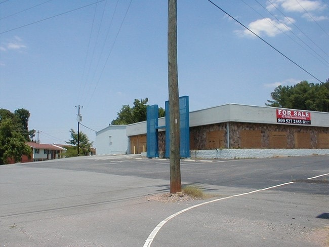

Property Detail
Broadview Dr
72400
.602AC PB40-131 RD 2357 & I-85 SERVICE RD
Vehiclerentalsvehiclesales
CLEVELAND
GB
North Carolina
B and X Area of moderate flood hazard, usually the area between the limits of the 100-year and 500-year floods.
29
2025
664.86 AC
2025
Cleveland County
950604
Charlotte
4,800 SF
Shelby-Kings Mountain, NC
NEARBY LISTINGS FOR SALE OR LEASE
DEMOGRAPHICS near Broadview Dr
1 mile
3 mile
5 mile
2025 Total Population
1,591
13,179
31,145
2030 Population
1,649
13,585
32,380
Pop Growth 2025-2030
+ 3.65%
+ 3.08%
+ 3.97%
Average Age
41
41
41
2025 Total Households
737
5,334
12,402
HH Growth 2025-2030
+ 3.53%
+ 3.13%
+ 4.08%
Median Household Inc
$32,500
$55,320
$64,212
Avg Household Size
2.10
2.40
2.40
2025 Avg HH Vehicles
2.00
2.00
2.00
Median Home Value
$234,117
$217,482
$227,188
Median Year Built
1976
1974
1978
Nearby Places
Map Layers
Map Styles
 Street
 Aerial
Layers
 Traffic
 Biking
Places
Listings with unknown addresses are not visible on the map
- Restaurants
- Banks
- Shops
- Fitness
- Groceries
PUBLIC TRANSPORTATION
AIRPORT
Charlotte/Douglas International
Drive
Walk
Distance
Charlotte/Douglas International
42 min
27.7 mi
Freight Ports
North Charleston Terminal
Drive
Walk
Distance
North Charleston Terminal
241 min
206.9 mi
Nearby Properties
Address
Land Use
TOTAL SIZE
Lot Size
Zoning
Address
Land Use
TOTAL SIZE
Lot Size
Zoning
163 AC
Address
Land Use
TOTAL SIZE
Lot Size
Zoning
536,116 SF
45.22 AC
HI
Address
Land Use
TOTAL SIZE
Lot Size
Zoning
469,498 SF
35.38 AC
STOR2
Address
Land Use
TOTAL SIZE
Lot Size
Zoning
12,183 SF
78.45 AC
INDS3
Address
Land Use
TOTAL SIZE
Lot Size
Zoning
Address
Land Use
TOTAL SIZE
Lot Size
Zoning
828 SF
85.98 AC
R10
Address
Land Use
TOTAL SIZE
Lot Size
Zoning
12.52 AC
RO
Address
Land Use
TOTAL SIZE
Lot Size
Zoning
300,993 SF
19.39 AC
HI
Address
Land Use
TOTAL SIZE
Lot Size
Zoning
1,276 SF
3,547.93 AC
Address
Land Use
TOTAL SIZE
Lot Size
Zoning
32.87 AC
Address
Land Use
TOTAL SIZE
Lot Size
Zoning
135,000 SF
20.43 AC
HI
Address
Land Use
TOTAL SIZE
Lot Size
Zoning
125.73 AC
LI
Address
Land Use
TOTAL SIZE
Lot Size
Zoning
175,610 SF
25.84 AC
LI
Address
Land Use
TOTAL SIZE
Lot Size
Zoning
32,880 SF
2.88 AC
R08
Address
Land Use
TOTAL SIZE
Lot Size
Zoning
16,414 SF
5 AC
R10
Address
Land Use
TOTAL SIZE
Lot Size
Zoning
44,094 SF
2.67 AC
HI
Address
Land Use
TOTAL SIZE
Lot Size
Zoning
4,935 SF
13.07 AC
LI
Address
Land Use
TOTAL SIZE
Lot Size
Zoning
7,000 SF
536.04 AC
HI
Address
Land Use
TOTAL SIZE
Lot Size
Zoning
149,927 SF
5 AC
LI
Address
Land Use
TOTAL SIZE
Lot Size
Zoning
111,034 SF
39.75 AC
OFF01
Address
Land Use
TOTAL SIZE
Lot Size
Zoning
32,926 SF
4.40 AC
RO
Address
Land Use
TOTAL SIZE
Lot Size
Zoning
1,500 SF
10.02 AC
INDS1
Address
Land Use
TOTAL SIZE
Lot Size
Zoning
12,320 SF
11.48 AC
R06
Address
Land Use
TOTAL SIZE
Lot Size
Zoning
100,225 SF
10.48 AC
HI
Address
Land Use
TOTAL SIZE
Lot Size
Zoning
11,920 SF
3.10 AC
GB
Address
Land Use
TOTAL SIZE
Lot Size
Zoning
42,045 SF
5 AC
GB
Address
Land Use
TOTAL SIZE
Lot Size
Zoning
233,000 SF
20.87 AC
INDS2
Address
Land Use
TOTAL SIZE
Lot Size
Zoning
2,700 SF
21.20 AC
GB
Address
Land Use
TOTAL SIZE
Lot Size
Zoning
5,291 SF
4 AC
RO
Address
Land Use
TOTAL SIZE
Lot Size
Zoning
187,920 SF
14.51 AC
LI
The World's #1 Commercial Real Estate Marketplace
Connect with us
© 2026 CoStar Group
The information above has been obtained from sources believed reliable. While we do not doubt its accuracy we have not verified it and make no guarantee, warranty or representation about it. It is your responsibility to independently confirm its accuracy and completeness. Any projections, opinions, assumptions, or estimates used are for example only and do not represent the current or future performance of the property. The value of this transaction to you depends on tax and other factors which should be evaluated by your tax, financial, and legal advisors. You and your advisors should conduct a careful, independent investigation of the property to determine to your satisfaction the suitability of the property for your needs.