Property Record
18300 E Mississippi Ave, Aurora, CO 80017

NEARBY LISTINGS FOR SALE OR LEASE
Property Detail
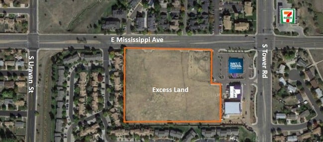
18300 E Mississippi Ave
Denver-Aurora-Centennial, CO
Commons At East Creek At Tower Landing S
1975-21-1-46-003
Arapahoe
Townhouserowhouse
Colorado
X
6.43 AC
08005C0184L
Aurora
1,860 SF
Denver
DEMOGRAPHICS near 18300 E Mississippi Ave
1 Mile
3 Mile
5 Mile
2024 Total Population
17,405
108,286
291,567
2029 Population
17,434
108,540
292,954
Pop Growth 2024-2029
+ 0.17%
+ 0.23%
+ 0.48%
Average Age
37
37
38
2024 Total Households
6,448
40,021
106,515
HH Growth 2024-2029
+ 0.09%
+ 0.32%
+ 0.47%
Median Household Inc
$76,406
$70,789
$72,385
Avg Household Size
2.60
2.60
2.60
2024 Avg HH Vehicles
2.00
2.00
2.00
Median Home Value
$341,406
$368,263
$387,548
Median Year Built
1985
1985
1983
Nearby Places
Map Layers
Map Styles
 Street
 Aerial
- Restaurants
- Banks
- Shops
- Fitness
- Groceries
PUBLIC TRANSPORTATION
COMMUTER RAIL
40Th Ave & Airport Blvd - Gateway Park Station Track 2 (Union Station to Denver Airport Station - Regional Transportation District)
DRIVE
WALK
Distance
40Th Ave & Airport Blvd - Gateway Park Station Track 2 (Union Station to Denver Airport Station - Regional Transportation District)
14 min
6.9 mi
Peoria Station Track 1 (Union Station to Denver Airport Station - Regional Transportation District)
DRIVE
WALK
Distance
Peoria Station Track 1 (Union Station to Denver Airport Station - Regional Transportation District)
15 min
9.3 mi
AIRPORT
Denver International
DRIVE
WALK
Distance
Denver International
25 min
17.4 mi
Freight Ports
Tulsa Port Of Catoosa
DRIVE
WALK
Distance
Tulsa Port Of Catoosa
718 min
700.2 mi
SALE & LEASE HISTORY
LISTING DATE
SALE/LEASE

Oct 04, 2016
For Sale
Nearby Properties
Address
Land Use
TOTAL SIZE
Lot Size
Zoning
Address
Land Use
TOTAL SIZE
Lot Size
Zoning
150,420 SF
4.75 AC
AR4PD
Address
Land Use
TOTAL SIZE
Lot Size
Zoning
116,490 SF
3.71 AC
PUD
Address
Land Use
TOTAL SIZE
Lot Size
Zoning
140,419 SF
8.37 AC
Address
Land Use
TOTAL SIZE
Lot Size
Zoning
161,437 SF
2.22 AC
RCZDC
Address
Land Use
TOTAL SIZE
Lot Size
Zoning
97,001 SF
Address
Land Use
TOTAL SIZE
Lot Size
Zoning
201,600 SF
44.67 AC
R1
Address
Land Use
TOTAL SIZE
Lot Size
Zoning
313,993 SF
5.69 AC
Address
Land Use
TOTAL SIZE
Lot Size
Zoning
140.42 AC
Address
Land Use
TOTAL SIZE
Lot Size
Zoning
277,940 SF
31.61 AC
Address
Land Use
TOTAL SIZE
Lot Size
Zoning
557,843 SF
21.35 AC
PUD
Address
Land Use
TOTAL SIZE
Lot Size
Zoning
315,058 SF
36.85 AC
RPCZD
Address
Land Use
TOTAL SIZE
Lot Size
Zoning
47,616 SF
140.42 AC
PUD
Address
Land Use
TOTAL SIZE
Lot Size
Zoning
43,568 SF
1.53 AC
Address
Land Use
TOTAL SIZE
Lot Size
Zoning
50,064 SF
3.52 AC
AMU
Address
Land Use
TOTAL SIZE
Lot Size
Zoning
277,985 SF
19.07 AC
Address
Land Use
TOTAL SIZE
Lot Size
Zoning
55,662 SF
3.71 AC
Address
Land Use
TOTAL SIZE
Lot Size
Zoning
142,378 SF
14.64 AC
Address
Land Use
TOTAL SIZE
Lot Size
Zoning
186,088 SF
10.15 AC
RZIND
Address
Land Use
TOTAL SIZE
Lot Size
Zoning
122,790 SF
14.52 AC
Address
Land Use
TOTAL SIZE
Lot Size
Zoning
368,462 SF
11.68 AC
RZMF
Address
Land Use
TOTAL SIZE
Lot Size
Zoning
364,024 SF
23.23 AC
PUD
Address
Land Use
TOTAL SIZE
Lot Size
Zoning
215,175 SF
28.07 AC
Address
Land Use
TOTAL SIZE
Lot Size
Zoning
521,364 SF
14.88 AC
PUD
Address
Land Use
TOTAL SIZE
Lot Size
Zoning
328,315 SF
8.15 AC
Address
Land Use
TOTAL SIZE
Lot Size
Zoning
145,510 SF
9.61 AC
Address
Land Use
TOTAL SIZE
Lot Size
Zoning
4,080 SF
116.55 AC
Address
Land Use
TOTAL SIZE
Lot Size
Zoning
345,688 SF
15.15 AC
PUD
Address
Land Use
TOTAL SIZE
Lot Size
Zoning
135,050 SF
19.38 AC
Address
Land Use
TOTAL SIZE
Lot Size
Zoning
398,436 SF
28.13 AC
The World's #1 Commercial Real Estate Marketplace
Connect with us
© 2026 CoStar Group
The information above has been obtained from sources believed reliable. While we do not doubt its accuracy we have not verified it and make no guarantee, warranty or representation about it. It is your responsibility to independently confirm its accuracy and completeness. Any projections, opinions, assumptions, or estimates used are for example only and do not represent the current or future performance of the property. The value of this transaction to you depends on tax and other factors which should be evaluated by your tax, financial, and legal advisors. You and your advisors should conduct a careful, independent investigation of the property to determine to your satisfaction the suitability of the property for your needs.