Property Record
12000 E 13Th Ave, Aurora, CO 80010


Save to a Folder
{{folder.Name}}
{{folder.ListingIds.length}} Properties
{{folder.ListingIds.length}} Property
Create a New Folder
Property Detail
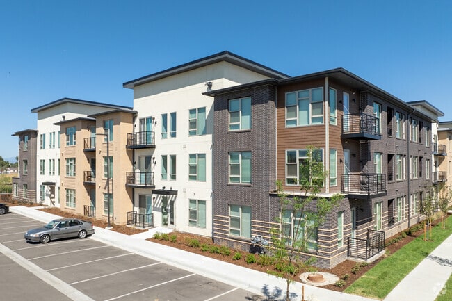
12000 E 13Th Ave
Denver-Aurora-Centennial, CO
TOWNSHIP T4S MAPPLATB E201 MAPPLATP 7580 SUBDIVISIONCD 046297 SUBDIVISIONNAME NEBO VILLAS SUBDIVISION FLG NO 2 BLOCK 001 LOT 001 LOT 1 BLK 1 NEBO VILLAS SUB FLG NO 2
1973-02-1-31-001
ARAPAHOE
Apartment
Colorado
B and X Area of moderate flood hazard, usually the area between the limits of the 100-year and 500-year floods.
1
2025
11.35 AC
2026
Delmar Parkway
007400
Denver
300,080 SF
NEARBY LISTINGS FOR SALE OR LEASE
DEMOGRAPHICS near 12000 E 13Th Ave
1 mile
3 mile
5 mile
2025 Total Population
24,689
173,360
425,002
2030 Population
25,286
177,983
434,991
Pop Growth 2025-2030
+ 2.42%
+ 2.67%
+ 2.35%
Average Age
36
37
37
2025 Total Households
8,357
64,312
164,013
HH Growth 2025-2030
+ 2.66%
+ 2.82%
+ 2.49%
Median Household Inc
$63,510
$71,215
$81,135
Avg Household Size
2.80
2.60
2.50
2025 Avg HH Vehicles
2.00
2.00
2.00
Median Home Value
$408,036
$448,575
$477,480
Median Year Built
1964
1979
1981
Nearby Places
Map Layers
Map Styles
 Street
 Aerial
Layers
 Traffic
 Biking
Places
Listings with unknown addresses are not visible on the map
- Restaurants
- Banks
- Shops
- Fitness
- Groceries
PUBLIC TRANSPORTATION
COMMUTER RAIL
Peoria Station Track 1 (Union Station to Denver Airport Station - Regional Transportation District)
Drive
Walk
Distance
Peoria Station Track 1 (Union Station to Denver Airport Station - Regional Transportation District)
6 min
2.9 mi
Peoria Station Track 2 (Union Station to Denver Airport Station - Regional Transportation District)
Drive
Walk
Distance
Peoria Station Track 2 (Union Station to Denver Airport Station - Regional Transportation District)
6 min
2.9 mi
AIRPORT
Denver International
Drive
Walk
Distance
Denver International
23 min
17.1 mi
Freight Ports
Tulsa Port Of Catoosa
Drive
Walk
Distance
Tulsa Port Of Catoosa
718 min
699.8 mi
Nearby Properties
Address
Land Use
TOTAL SIZE
Lot Size
Zoning
Address
Land Use
TOTAL SIZE
Lot Size
Zoning
368,450 SF
48.59 AC
Address
Land Use
TOTAL SIZE
Lot Size
Zoning
353,829 SF
4.51 AC
Address
Land Use
TOTAL SIZE
Lot Size
Zoning
880,442 SF
67.95 AC
I-B
Address
Land Use
TOTAL SIZE
Lot Size
Zoning
244,271 SF
15.30 AC
Address
Land Use
TOTAL SIZE
Lot Size
Zoning
525,050 SF
105.06 AC
Address
Land Use
TOTAL SIZE
Lot Size
Zoning
390,822 SF
13.47 AC
O-1
Address
Land Use
TOTAL SIZE
Lot Size
Zoning
135,803 SF
3.36 AC
Address
Land Use
TOTAL SIZE
Lot Size
Zoning
273,184 SF
1.89 AC
Address
Land Use
TOTAL SIZE
Lot Size
Zoning
131,544 SF
3.92 AC
Address
Land Use
TOTAL SIZE
Lot Size
Zoning
557,843 SF
21.35 AC
PUD
Address
Land Use
TOTAL SIZE
Lot Size
Zoning
315,058 SF
36.85 AC
RPCZD
Address
Land Use
TOTAL SIZE
Lot Size
Zoning
646,975 SF
32.60 AC
M-IMX-8
Address
Land Use
TOTAL SIZE
Lot Size
Zoning
269,622 SF
12.90 AC
Address
Land Use
TOTAL SIZE
Lot Size
Zoning
277,985 SF
19.07 AC
Address
Land Use
TOTAL SIZE
Lot Size
Zoning
624,019 SF
4.09 AC
Address
Land Use
TOTAL SIZE
Lot Size
Zoning
400,000 SF
22.91 AC
I-0
Address
Land Use
TOTAL SIZE
Lot Size
Zoning
178,235 SF
1.38 AC
RFBAD
Address
Land Use
TOTAL SIZE
Lot Size
Zoning
672,521 SF
0.61 AC
RB3
Address
Land Use
TOTAL SIZE
Lot Size
Zoning
74,966 SF
1.79 AC
Address
Land Use
TOTAL SIZE
Lot Size
Zoning
466,055 SF
24.82 AC
M-IMX-5
Address
Land Use
TOTAL SIZE
Lot Size
Zoning
176,751 SF
28.75 AC
Address
Land Use
TOTAL SIZE
Lot Size
Zoning
366,800 SF
20.21 AC
Address
Land Use
TOTAL SIZE
Lot Size
Zoning
130,531 SF
3.41 AC
Address
Land Use
TOTAL SIZE
Lot Size
Zoning
102,833 SF
14.27 AC
R-MU-20
Address
Land Use
TOTAL SIZE
Lot Size
Zoning
540,166 SF
2.80 AC
Address
Land Use
TOTAL SIZE
Lot Size
Zoning
455,850 SF
18.65 AC
I-B
Address
Land Use
TOTAL SIZE
Lot Size
Zoning
111,358 SF
1.21 AC
Address
Land Use
TOTAL SIZE
Lot Size
Zoning
277,005 SF
16.37 AC
Address
Land Use
TOTAL SIZE
Lot Size
Zoning
283,716 SF
14.16 AC
B-4
Address
Land Use
TOTAL SIZE
Lot Size
Zoning
142,708 SF
14.61 AC
The World's #1 Commercial Real Estate Marketplace
Connect with us
© 2026 CoStar Group
The information above has been obtained from sources believed reliable. While we do not doubt its accuracy we have not verified it and make no guarantee, warranty or representation about it. It is your responsibility to independently confirm its accuracy and completeness. Any projections, opinions, assumptions, or estimates used are for example only and do not represent the current or future performance of the property. The value of this transaction to you depends on tax and other factors which should be evaluated by your tax, financial, and legal advisors. You and your advisors should conduct a careful, independent investigation of the property to determine to your satisfaction the suitability of the property for your needs.