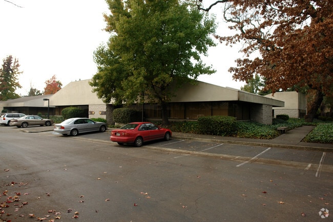
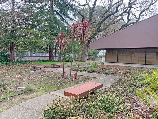
Property Record
1400 N Dutton Ave, Santa Rosa, CA 95401
Save to a Folder
{{folder.Name}}
{{folder.ListingIds.length}} Properties
{{folder.ListingIds.length}} Property
Create a New Folder
Property Detail
1400 N Dutton Ave
036-450-012
Sonoma
Officecondo
California
CITYSR
0.07 AC
B and X Area of moderate flood hazard, usually the area between the limits of the 100-year and 500-year floods.
Santa Rosa
2025
North Bay/Santa Rosa
2025
Santa Rosa-Petaluma, CA
153001
NEARBY LISTINGS FOR SALE OR LEASE
DEMOGRAPHICS near 1400 N Dutton Ave
1 mile
3 mile
5 mile
2025 Total Population
24,689
135,457
202,098
2030 Population
24,738
136,624
203,081
Pop Growth 2025-2030
+ 0.20%
+ 0.86%
+ 0.49%
Average Age
38
41
41
2025 Total Households
8,823
49,275
74,320
HH Growth 2025-2030
+ 0.32%
+ 0.98%
+ 0.56%
Median Household Inc
$83,194
$93,827
$96,551
Avg Household Size
2.70
2.60
2.60
2025 Avg HH Vehicles
2.00
2.00
2.00
Median Home Value
$632,385
$723,165
$743,728
Median Year Built
1976
1981
1980
Nearby Places
Map Layers
Map Styles
 Street
 Aerial
Layers
 Traffic
 Biking
Places
Listings with unknown addresses are not visible on the map
- Restaurants
- Banks
- Shops
- Fitness
- Groceries
PUBLIC TRANSPORTATION
COMMUTER RAIL
Drive
Walk
Distance
2 min
8 min
0.4 mi
Drive
Walk
Distance
4 min
1.6 mi
AIRPORT
Charles M Schulz - Sonoma County
Drive
Walk
Distance
Charles M Schulz - Sonoma County
12 min
7.4 mi
Freight Ports
Port of Richmond
Drive
Walk
Distance
Port of Richmond
65 min
49.7 mi
SALE & LEASE HISTORY
LISTING DATE
SALE/LEASE

Jan 28, 2025
For Sale
Nearby Properties
Address
Land Use
TOTAL SIZE
Lot Size
Zoning
Address
Land Use
TOTAL SIZE
Lot Size
Zoning
191,452 SF
128.68 AC
CITYSR
Address
Land Use
TOTAL SIZE
Lot Size
Zoning
142,169 SF
7.42 AC
CITYSR
Address
Land Use
TOTAL SIZE
Lot Size
Zoning
22.45 AC
MCPD
Address
Land Use
TOTAL SIZE
Lot Size
Zoning
Address
Land Use
TOTAL SIZE
Lot Size
Zoning
22,841 SF
8.23 AC
Address
Land Use
TOTAL SIZE
Lot Size
Zoning
59,220 SF
22.98 AC
C-2
Address
Land Use
TOTAL SIZE
Lot Size
Zoning
222,278 SF
13.39 AC
CITYSR
Address
Land Use
TOTAL SIZE
Lot Size
Zoning
191,385 SF
13.77 AC
C2P
Address
Land Use
TOTAL SIZE
Lot Size
Zoning
47,330 SF
22.01 AC
Address
Land Use
TOTAL SIZE
Lot Size
Zoning
167,485 SF
7.81 AC
Address
Land Use
TOTAL SIZE
Lot Size
Zoning
82,685 SF
9.13 AC
CITYSR
Address
Land Use
TOTAL SIZE
Lot Size
Zoning
77,682 SF
0.51 AC
Address
Land Use
TOTAL SIZE
Lot Size
Zoning
131,210 SF
10.41 AC
Address
Land Use
TOTAL SIZE
Lot Size
Zoning
14,956 SF
9.77 AC
PC
Address
Land Use
TOTAL SIZE
Lot Size
Zoning
116,188 SF
6.55 AC
CITYSR
Address
Land Use
TOTAL SIZE
Lot Size
Zoning
57,740 SF
8.06 AC
Address
Land Use
TOTAL SIZE
Lot Size
Zoning
1,465 SF
9.33 AC
CITYSR
Address
Land Use
TOTAL SIZE
Lot Size
Zoning
90,079 SF
3.09 AC
Address
Land Use
TOTAL SIZE
Lot Size
Zoning
184,758 SF
9.23 AC
Address
Land Use
TOTAL SIZE
Lot Size
Zoning
9,450 SF
0.76 AC
Address
Land Use
TOTAL SIZE
Lot Size
Zoning
90,330 SF
6.72 AC
Address
Land Use
TOTAL SIZE
Lot Size
Zoning
107,765 SF
5.70 AC
CITYSR
Address
Land Use
TOTAL SIZE
Lot Size
Zoning
105,696 SF
5.46 AC
Address
Land Use
TOTAL SIZE
Lot Size
Zoning
87,300 SF
6.64 AC
Address
Land Use
TOTAL SIZE
Lot Size
Zoning
71,800 SF
7.76 AC
CIPD
Address
Land Use
TOTAL SIZE
Lot Size
Zoning
85,034 SF
5.43 AC
Address
Land Use
TOTAL SIZE
Lot Size
Zoning
19,444 SF
7.91 AC
C2
Address
Land Use
TOTAL SIZE
Lot Size
Zoning
146,611 SF
9.44 AC
Address
Land Use
TOTAL SIZE
Lot Size
Zoning
119,819 SF
7.37 AC
CITYSR
Address
Land Use
TOTAL SIZE
Lot Size
Zoning
85,920 SF
5.69 AC
CITYSR
The World's #1 Commercial Real Estate Marketplace
Connect with us
© 2026 CoStar Group
The information above has been obtained from sources believed reliable. While we do not doubt its accuracy we have not verified it and make no guarantee, warranty or representation about it. It is your responsibility to independently confirm its accuracy and completeness. Any projections, opinions, assumptions, or estimates used are for example only and do not represent the current or future performance of the property. The value of this transaction to you depends on tax and other factors which should be evaluated by your tax, financial, and legal advisors. You and your advisors should conduct a careful, independent investigation of the property to determine to your satisfaction the suitability of the property for your needs.