Property Record
52 N Broadway, Denver, CO 80203


Save to a Folder
{{folder.Name}}
{{folder.ListingIds.length}} Properties
{{folder.ListingIds.length}} Property
Create a New Folder
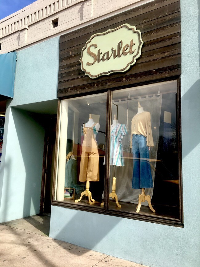
Property Detail
52 N Broadway
5104-08-028
WEST125 FT LOTS10-15 EXC REAR 8 FT SD LOTS
Storebuilding
DENVER
G-MS-5
Colorado
B and X Area of moderate flood hazard, usually the area between the limits of the 100-year and 500-year floods.
10-15
2025
0.42 AC
2025
Central
002802
Denver
18,798 SF
Denver-Aurora-Centennial, CO
NEARBY LISTINGS FOR SALE OR LEASE
DEMOGRAPHICS near 52 N Broadway
1 mile
3 mile
5 mile
2025 Total Population
33,246
242,486
564,904
2030 Population
34,448
249,030
578,189
Pop Growth 2025-2030
+ 3.62%
+ 2.70%
+ 2.35%
Average Age
38
38
38
2025 Total Households
19,760
124,650
264,956
HH Growth 2025-2030
+ 3.70%
+ 2.98%
+ 2.59%
Median Household Inc
$107,329
$99,027
$96,681
Avg Household Size
1.60
1.80
2.00
2025 Avg HH Vehicles
1.00
1.00
2.00
Median Home Value
$745,192
$777,473
$726,166
Median Year Built
1966
1971
1968
Nearby Places
Map Layers
Map Styles
 Street
 Aerial
Layers
 Traffic
 Biking
Places
Listings with unknown addresses are not visible on the map
- Restaurants
- Banks
- Shops
- Fitness
- Groceries
PUBLIC TRANSPORTATION
TRANSIT/SUBWAY
Alameda (C Line - Denver Regional Transportation District Light Rail (TheRide), D Line - Denver Regional Transportation District Light Rail (TheRide), E Line - Denver Regional Transportation District Light Rail (TheRide), F Line - Denver Regional Transportation District Light Rail (TheRide), H Line - Denver Regional Transportation District Light Rail (TheRide))
Drive
Walk
Distance
Alameda (C Line - Denver Regional Transportation District Light Rail (TheRide), D Line - Denver Regional Transportation District Light Rail (TheRide), E Line - Denver Regional Transportation District Light Rail (TheRide), F Line - Denver Regional Transportation District Light Rail (TheRide), H Line - Denver Regional Transportation District Light Rail (TheRide))
2 min
18 min
0.9 mi
COMMUTER RAIL
Drive
Walk
Distance
8 min
3.0 mi
Union Station: LoDo-Coors Field-16th Street Mall (C Line - Denver Regional Transportation District Light Rail (TheRide), E Line - Denver Regional Transportation District Light Rail (TheRide), W Line - Denver Regional Transportation District Light Rail (TheRide))
Drive
Walk
Distance
Union Station: LoDo-Coors Field-16th Street Mall (C Line - Denver Regional Transportation District Light Rail (TheRide), E Line - Denver Regional Transportation District Light Rail (TheRide), W Line - Denver Regional Transportation District Light Rail (TheRide))
8 min
3.1 mi
AIRPORT
Denver International
Drive
Walk
Distance
Denver International
39 min
28.9 mi
SALE & LEASE HISTORY
LISTING DATE
SALE/LEASE

Mar 08, 2019
For Lease
Nearby Properties
Address
Land Use
TOTAL SIZE
Lot Size
Zoning
Address
Land Use
TOTAL SIZE
Lot Size
Zoning
921,863 SF
2.01 AC
C-MX
Address
Land Use
TOTAL SIZE
Lot Size
Zoning
1,882,179 SF
21.15 AC
D-TD
Address
Land Use
TOTAL SIZE
Lot Size
Zoning
1,721,086 SF
21.34 AC
C-MU-30
Address
Land Use
TOTAL SIZE
Lot Size
Zoning
798,837 SF
1.67 AC
C-MX
Address
Land Use
TOTAL SIZE
Lot Size
Zoning
598,652 SF
1.38 AC
G-TR
Address
Land Use
TOTAL SIZE
Lot Size
Zoning
657,947 SF
5.02 AC
C-RX
Address
Land Use
TOTAL SIZE
Lot Size
Zoning
729,679 SF
C-MX
Address
Land Use
TOTAL SIZE
Lot Size
Zoning
857,233 SF
10.26 AC
CMP-H
Address
Land Use
TOTAL SIZE
Lot Size
Zoning
856,519 SF
10.04 AC
B-3
Address
Land Use
TOTAL SIZE
Lot Size
Zoning
472,235 SF
1.98 AC
C-RX
Address
Land Use
TOTAL SIZE
Lot Size
Zoning
1,096,923 SF
16.14 AC
CMP-H
Address
Land Use
TOTAL SIZE
Lot Size
Zoning
624,481 SF
1.87 AC
C-MX
Address
Land Use
TOTAL SIZE
Lot Size
Zoning
451,860 SF
1 AC
C-MX
Address
Land Use
TOTAL SIZE
Lot Size
Zoning
794,383 SF
0.90 AC
D-TD
Address
Land Use
TOTAL SIZE
Lot Size
Zoning
694,425 SF
1.92 AC
C-MX
Address
Land Use
TOTAL SIZE
Lot Size
Zoning
411,402 SF
6.34 AC
C-RX
Address
Land Use
TOTAL SIZE
Lot Size
Zoning
405,436 SF
2.45 AC
C-MX
Address
Land Use
TOTAL SIZE
Lot Size
Zoning
299,368 SF
0.71 AC
C-MX
Address
Land Use
TOTAL SIZE
Lot Size
Zoning
297,776 SF
2.88 AC
C-MX
Address
Land Use
TOTAL SIZE
Lot Size
Zoning
402,700 SF
1.15 AC
C-RX
Address
Land Use
TOTAL SIZE
Lot Size
Zoning
411,031 SF
1.66 AC
I-MX
Address
Land Use
TOTAL SIZE
Lot Size
Zoning
352,226 SF
1.01 AC
ASQ
Address
Land Use
TOTAL SIZE
Lot Size
Zoning
296,778 SF
2.28 AC
U-MS
Address
Land Use
TOTAL SIZE
Lot Size
Zoning
341,972 SF
1.21 AC
G-TR
Address
Land Use
TOTAL SIZE
Lot Size
Zoning
1,048,471 SF
2.44 AC
PUD
Address
Land Use
TOTAL SIZE
Lot Size
Zoning
412,345 SF
0.82 AC
C-MX
Address
Land Use
TOTAL SIZE
Lot Size
Zoning
365,674 SF
2.60 AC
G-MU
Address
Land Use
TOTAL SIZE
Lot Size
Zoning
417,566 SF
2.60 AC
G-MU
Address
Land Use
TOTAL SIZE
Lot Size
Zoning
1,567,575 SF
1.40 AC
D-C
Address
Land Use
TOTAL SIZE
Lot Size
Zoning
318,052 SF
2.73 AC
C-MX
The World's #1 Commercial Real Estate Marketplace
Connect with us
© 2026 CoStar Group
The information above has been obtained from sources believed reliable. While we do not doubt its accuracy we have not verified it and make no guarantee, warranty or representation about it. It is your responsibility to independently confirm its accuracy and completeness. Any projections, opinions, assumptions, or estimates used are for example only and do not represent the current or future performance of the property. The value of this transaction to you depends on tax and other factors which should be evaluated by your tax, financial, and legal advisors. You and your advisors should conduct a careful, independent investigation of the property to determine to your satisfaction the suitability of the property for your needs.