Property Record
2801 Nw 79Th Ave, Miami, FL 33122
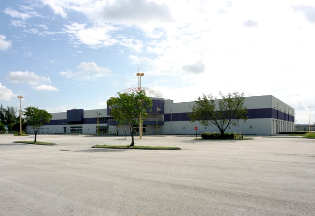

Property Detail
2801 Nw 79Th Ave
35-3027-037-0010
BLUE HERON LAKE PB 144-2 T-15487 TR C LESS BEG 187.31FTE OF SW COR OF TR C TH N 00 DEG W 5.50FT N 89 DEG E 11FT S 0 DEG E 5.50FT S 89 DEG W 11FT TO POB & LESS BEG 339.19FTE OF SW COR OF TR C TH N 00 DEG W 2.50FT N 89 DEG E 11FT S 00 DEG E 2.50FT S 89
Hospitalpublic
Miami-Dade
6400
Florida
AH Areas with a 1% annual chance of shallow flooding, usually in the form of a pond, withan average depth ranging from 1 to 3 feet. These areas have a 26% chance of flooding over the life of a 30-year mortgage.
13.61 AC
0
Miami Airport West
2025
South Florida
009010
Miami-Miami Beach-Kendall, FL
481,242 SF
NEARBY LISTINGS FOR SALE OR LEASE
DEMOGRAPHICS near 2801 Nw 79Th Ave
1 mile
3 mile
5 mile
2025 Total Population
3,524
124,692
475,998
2030 Population
3,969
133,709
507,235
Pop Growth 2025-2030
+ 12.63%
+ 7.23%
+ 6.56%
Average Age
35
42
43
2025 Total Households
1,436
45,968
165,532
HH Growth 2025-2030
+ 12.40%
+ 7.20%
+ 6.54%
Median Household Inc
$74,539
$69,815
$66,999
Avg Household Size
2.40
2.60
2.80
2025 Avg HH Vehicles
1.00
2.00
2.00
Median Home Value
$720,930
$451,700
$478,747
Median Year Built
2011
1981
1976
Nearby Places
Map Layers
Map Styles
 Street
 Aerial
Layers
 Traffic
 Biking
Places
Listings with unknown addresses are not visible on the map
- Restaurants
- Banks
- Shops
- Fitness
- Groceries
PUBLIC TRANSPORTATION
COMMUTER RAIL
Palmetto (Metrorail Green Line - Miami-Dade Transit (Metrorail/Metromover))
Drive
Walk
Distance
Palmetto (Metrorail Green Line - Miami-Dade Transit (Metrorail/Metromover))
8 min
4.3 mi
Okeechobee (Metrorail Green Line - Miami-Dade Transit (Metrorail/Metromover))
Drive
Walk
Distance
Okeechobee (Metrorail Green Line - Miami-Dade Transit (Metrorail/Metromover))
10 min
5.2 mi
AIRPORT
Miami International
Drive
Walk
Distance
Miami International
9 min
2.9 mi
Fort Lauderdale/Hollywood International
Drive
Walk
Distance
Fort Lauderdale/Hollywood International
42 min
28.9 mi
Freight Ports
Port of Miami
Drive
Walk
Distance
Port of Miami
22 min
12.4 mi
Nearby Properties
Address
Land Use
TOTAL SIZE
Lot Size
Zoning
Address
Land Use
TOTAL SIZE
Lot Size
Zoning
851,502 SF
11.73 AC
6119
Address
Land Use
TOTAL SIZE
Lot Size
Zoning
1,680,493 SF
23.71 AC
4100
Address
Land Use
TOTAL SIZE
Lot Size
Zoning
465,663 SF
11.29 AC
4100
Address
Land Use
TOTAL SIZE
Lot Size
Zoning
666,015 SF
4 AC
6119
Address
Land Use
TOTAL SIZE
Lot Size
Zoning
582,921 SF
4.51 AC
6119
Address
Land Use
TOTAL SIZE
Lot Size
Zoning
671,088 SF
19.84 AC
6400
Address
Land Use
TOTAL SIZE
Lot Size
Zoning
929,765 SF
453.69 AC
6119
Address
Land Use
TOTAL SIZE
Lot Size
Zoning
418,532 SF
17.95 AC
7300
Address
Land Use
TOTAL SIZE
Lot Size
Zoning
448,531 SF
37 AC
6400
Address
Land Use
TOTAL SIZE
Lot Size
Zoning
328,554 SF
668.26 AC
8900
Address
Land Use
TOTAL SIZE
Lot Size
Zoning
608,139 SF
5.80 AC
6119
Address
Land Use
TOTAL SIZE
Lot Size
Zoning
884,102 SF
28.46 AC
7300
Address
Land Use
TOTAL SIZE
Lot Size
Zoning
612,289 SF
3.38 AC
6119
Address
Land Use
TOTAL SIZE
Lot Size
Zoning
1,700 SF
7.24 AC
7100
Address
Land Use
TOTAL SIZE
Lot Size
Zoning
755,156 SF
29.44 AC
7100
Address
Land Use
TOTAL SIZE
Lot Size
Zoning
466,402 SF
2.22 AC
6106
Address
Land Use
TOTAL SIZE
Lot Size
Zoning
429,568 SF
7.44 AC
6400
Address
Land Use
TOTAL SIZE
Lot Size
Zoning
352,663 SF
0.65 AC
6119
Address
Land Use
TOTAL SIZE
Lot Size
Zoning
438,387 SF
16.20 AC
3900
Address
Land Use
TOTAL SIZE
Lot Size
Zoning
453,404 SF
469.53 AC
7300
Address
Land Use
TOTAL SIZE
Lot Size
Zoning
428,212 SF
17.56 AC
3900
Address
Land Use
TOTAL SIZE
Lot Size
Zoning
468,218 SF
17.06 AC
7100
Address
Land Use
TOTAL SIZE
Lot Size
Zoning
344,101 SF
0.74 AC
6119
Address
Land Use
TOTAL SIZE
Lot Size
Zoning
366,237 SF
9.24 AC
4100
Address
Land Use
TOTAL SIZE
Lot Size
Zoning
687,304 SF
3.03 AC
6119
Address
Land Use
TOTAL SIZE
Lot Size
Zoning
527,157 SF
4.15 AC
6119
Address
Land Use
TOTAL SIZE
Lot Size
Zoning
538,739 SF
5.05 AC
7100
Address
Land Use
TOTAL SIZE
Lot Size
Zoning
387,903 SF
4.49 AC
6119
Address
Land Use
TOTAL SIZE
Lot Size
Zoning
516,193 SF
571.83 AC
8900
The World's #1 Commercial Real Estate Marketplace
Connect with us
© 2026 CoStar Group
The information above has been obtained from sources believed reliable. While we do not doubt its accuracy we have not verified it and make no guarantee, warranty or representation about it. It is your responsibility to independently confirm its accuracy and completeness. Any projections, opinions, assumptions, or estimates used are for example only and do not represent the current or future performance of the property. The value of this transaction to you depends on tax and other factors which should be evaluated by your tax, financial, and legal advisors. You and your advisors should conduct a careful, independent investigation of the property to determine to your satisfaction the suitability of the property for your needs.