Property Record
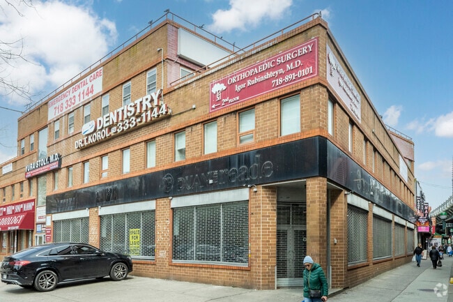
3051 Ocean Ave, Brooklyn, NY 11235


NEARBY LISTINGS FOR SALE OR LEASE
Property Detail
3051 Ocean Ave
08669-0062
ID2004111801321001
Officebuilding
Kings
AE
New York
3604970354F
62
2024
0.33 AC
2025
South Brooklyn
060800
Long Island (New York)
24,794 SF
New York-Jersey City-White Plains, NY-NJ
DEMOGRAPHICS near 3051 Ocean Ave
1 mile
3 mile
5 mile
2024 Total Population
78,207
451,513
1,032,648
2029 Population
74,280
422,486
959,218
Pop Growth 2024-2029
(5.02%)
(6.43%)
(7.11%)
Average Age
47
42
40
2024 Total Households
33,176
164,498
355,680
HH Growth 2024-2029
(5.32%)
(6.79%)
(7.43%)
Median Household Inc
$53,116
$58,719
$64,246
Avg Household Size
2.30
2.60
2.80
2024 Avg HH Vehicles
1.00
1.00
1.00
Median Home Value
$568,136
$752,148
$786,077
Median Year Built
1961
1949
1948
Nearby Places
Map Layers
Map Styles
 Street
 Aerial
Transit
 Traffic
 Biking
Places
Listings with unknown addresses are not visible on the map
- Restaurants
- Banks
- Shops
- Fitness
- Groceries
PUBLIC TRANSPORTATION
TRANSIT/SUBWAY
Ocean Parkway (Q - New York MTA Subway (The Subway))
Drive
Walk
Distance
Ocean Parkway (Q - New York MTA Subway (The Subway))
1 min
0 min
0.0 mi
Brighton Beach (B - New York MTA Subway (The Subway), Q - New York MTA Subway (The Subway))
Drive
Walk
Distance
Brighton Beach (B - New York MTA Subway (The Subway), Q - New York MTA Subway (The Subway))
2 min
7 min
0.4 mi
West 8 Street-New York Aquarium (F - New York MTA Subway (The Subway), Q - New York MTA Subway (The Subway))
Drive
Walk
Distance
West 8 Street-New York Aquarium (F - New York MTA Subway (The Subway), Q - New York MTA Subway (The Subway))
3 min
12 min
0.6 mi
Neptune Avenue (F - New York MTA Subway (The Subway))
Drive
Walk
Distance
Neptune Avenue (F - New York MTA Subway (The Subway))
2 min
12 min
0.7 mi
Coney Island-Stillwell Avenue (D - New York MTA Subway (The Subway), F - New York MTA Subway (The Subway), N - New York MTA Subway (The Subway), Q - New York MTA Subway (The Subway))
Drive
Walk
Distance
Coney Island-Stillwell Avenue (D - New York MTA Subway (The Subway), F - New York MTA Subway (The Subway), N - New York MTA Subway (The Subway), Q - New York MTA Subway (The Subway))
3 min
16 min
0.9 mi
COMMUTER RAIL
Grasmere (Staten Island Railway - New York MTA Subway (The Subway))
Drive
Walk
Distance
Grasmere (Staten Island Railway - New York MTA Subway (The Subway))
17 min
9.0 mi
Clifton (Staten Island Railway - New York MTA Subway (The Subway))
Drive
Walk
Distance
Clifton (Staten Island Railway - New York MTA Subway (The Subway))
17 min
9.4 mi
AIRPORT
John F Kennedy International
Drive
Walk
Distance
John F Kennedy International
22 min
15.4 mi
LaGuardia
Drive
Walk
Distance
LaGuardia
34 min
22.2 mi
Newark Liberty International
Drive
Walk
Distance
Newark Liberty International
38 min
24.0 mi
Freight Ports
NY - Red Hook Container Terminal
Drive
Walk
Distance
NY - Red Hook Container Terminal
17 min
8.9 mi
SALE & LEASE HISTORY
LISTING DATE
SALE/LEASE

Sep 26, 2016
For Lease
Nov 28, 2017
For Lease
May 16, 2023
For Lease
Jun 27, 2019
For Lease
Nearby Properties
Address
Land Use
TOTAL SIZE
Lot Size
Zoning
Address
Land Use
TOTAL SIZE
Lot Size
Zoning
200 SF
281.30 AC
R4
Address
Land Use
TOTAL SIZE
Lot Size
Zoning
200 SF
281.30 AC
R4
Address
Land Use
TOTAL SIZE
Lot Size
Zoning
200 SF
281.30 AC
R4
Address
Land Use
TOTAL SIZE
Lot Size
Zoning
200 SF
281.30 AC
R4
Address
Land Use
TOTAL SIZE
Lot Size
Zoning
200 SF
281.30 AC
R4
Address
Land Use
TOTAL SIZE
Lot Size
Zoning
200 SF
281.30 AC
R4
Address
Land Use
TOTAL SIZE
Lot Size
Zoning
200 SF
281.30 AC
R4
Address
Land Use
TOTAL SIZE
Lot Size
Zoning
200 SF
281.30 AC
R4
Address
Land Use
TOTAL SIZE
Lot Size
Zoning
200 SF
281.30 AC
R4
Address
Land Use
TOTAL SIZE
Lot Size
Zoning
200 SF
281.30 AC
R4
Address
Land Use
TOTAL SIZE
Lot Size
Zoning
200 SF
281.30 AC
R4
Address
Land Use
TOTAL SIZE
Lot Size
Zoning
200 SF
281.30 AC
R4
Address
Land Use
TOTAL SIZE
Lot Size
Zoning
200 SF
281.30 AC
R4
Address
Land Use
TOTAL SIZE
Lot Size
Zoning
200 SF
281.30 AC
R4
Address
Land Use
TOTAL SIZE
Lot Size
Zoning
200 SF
281.30 AC
R4
Address
Land Use
TOTAL SIZE
Lot Size
Zoning
200 SF
281.30 AC
R4
Address
Land Use
TOTAL SIZE
Lot Size
Zoning
200 SF
281.30 AC
R4
Address
Land Use
TOTAL SIZE
Lot Size
Zoning
200 SF
281.30 AC
R4
Address
Land Use
TOTAL SIZE
Lot Size
Zoning
200 SF
281.30 AC
R4
Address
Land Use
TOTAL SIZE
Lot Size
Zoning
200 SF
281.30 AC
R4
Address
Land Use
TOTAL SIZE
Lot Size
Zoning
200 SF
281.30 AC
R4
Address
Land Use
TOTAL SIZE
Lot Size
Zoning
200 SF
281.30 AC
R4
Address
Land Use
TOTAL SIZE
Lot Size
Zoning
200 SF
281.30 AC
R4
Address
Land Use
TOTAL SIZE
Lot Size
Zoning
200 SF
281.30 AC
R4
Address
Land Use
TOTAL SIZE
Lot Size
Zoning
200 SF
281.30 AC
R4
Address
Land Use
TOTAL SIZE
Lot Size
Zoning
200 SF
281.30 AC
R4
Address
Land Use
TOTAL SIZE
Lot Size
Zoning
200 SF
281.30 AC
R4
Address
Land Use
TOTAL SIZE
Lot Size
Zoning
200 SF
281.30 AC
R4
Address
Land Use
TOTAL SIZE
Lot Size
Zoning
200 SF
281.30 AC
R4
Address
Land Use
TOTAL SIZE
Lot Size
Zoning
200 SF
281.30 AC
R4
The World's #1 Commercial Real Estate Marketplace
Connect with us
© 2026 CoStar Group
The information above has been obtained from sources believed reliable. While we do not doubt its accuracy we have not verified it and make no guarantee, warranty or representation about it. It is your responsibility to independently confirm its accuracy and completeness. Any projections, opinions, assumptions, or estimates used are for example only and do not represent the current or future performance of the property. The value of this transaction to you depends on tax and other factors which should be evaluated by your tax, financial, and legal advisors. You and your advisors should conduct a careful, independent investigation of the property to determine to your satisfaction the suitability of the property for your needs.