Property Record
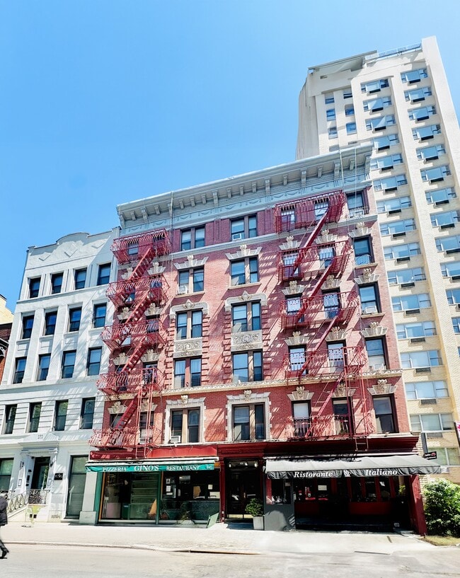
345 E 83Rd St, New York, NY 10028


Save to a Folder
{{folder.Name}}
{{folder.ListingIds.length}} Properties
{{folder.ListingIds.length}} Property
Create a New Folder
This Property Is For Sale
Property Detail
345 E 83Rd St
1546-0021
New York
Apartment
New York
R8B
21
B and X Area of moderate flood hazard, usually the area between the limits of the 100-year and 500-year floods.
0.12 AC
2025
Yorkville
2026
New York City
013800
New York-Jersey City-White Plains, NY-NJ
22,701 SF
NEARBY LISTINGS FOR SALE OR LEASE
DEMOGRAPHICS near 345 E 83Rd St
1 mile
3 mile
5 mile
2025 Total Population
233,945
1,307,144
3,027,334
2030 Population
243,947
1,358,290
3,113,763
Pop Growth 2025-2030
+ 4.28%
+ 3.91%
+ 2.85%
Average Age
43
41
40
2025 Total Households
119,851
623,392
1,301,352
HH Growth 2025-2030
+ 4.84%
+ 4.25%
+ 3.36%
Median Household Inc
$132,816
$107,355
$88,986
Avg Household Size
1.90
2.00
2.20
2025 Avg HH Vehicles
.00
.00
.00
Median Home Value
$1,039,670
$1,000,402
$880,288
Median Year Built
1961
1959
1955
Nearby Places
Map Layers
Map Styles
 Street
 Aerial
Layers
 Traffic
 Biking
Places
Listings with unknown addresses are not visible on the map
- Restaurants
- Banks
- Shops
- Fitness
- Groceries
PUBLIC TRANSPORTATION
TRANSIT/SUBWAY
86 Street (4,5,6 Line) (4 - New York MTA Subway (The Subway), 5 - New York MTA Subway (The Subway), 6 - New York MTA Subway (The Subway))
Drive
Walk
Distance
86 Street (4,5,6 Line) (4 - New York MTA Subway (The Subway), 5 - New York MTA Subway (The Subway), 6 - New York MTA Subway (The Subway))
3 min
10 min
0.5 mi
77 Street (4,6 Line) (4 - New York MTA Subway (The Subway), 6 - New York MTA Subway (The Subway))
Drive
Walk
Distance
77 Street (4,6 Line) (4 - New York MTA Subway (The Subway), 6 - New York MTA Subway (The Subway))
3 min
13 min
0.7 mi
96 Street (4,6 Line) (4 - New York MTA Subway (The Subway), 6 - New York MTA Subway (The Subway))
Drive
Walk
Distance
96 Street (4,6 Line) (4 - New York MTA Subway (The Subway), 6 - New York MTA Subway (The Subway))
4 min
19 min
1.0 mi
COMMUTER RAIL
Drive
Walk
Distance
8 min
2.4 mi
Harlem-125th Street Station (Harlem Line - Metro-North Commuter Railroad Company (Metro-North), Hudson Line - Metro-North Commuter Railroad Company (Metro-North), New Haven Line - Metro-North Commuter Railroad Company (Metro-North))
Drive
Walk
Distance
Harlem-125th Street Station (Harlem Line - Metro-North Commuter Railroad Company (Metro-North), Hudson Line - Metro-North Commuter Railroad Company (Metro-North), New Haven Line - Metro-North Commuter Railroad Company (Metro-North))
7 min
2.6 mi
AIRPORT
LaGuardia
Drive
Walk
Distance
LaGuardia
20 min
8.2 mi
Newark Liberty International
Drive
Walk
Distance
Newark Liberty International
31 min
17.1 mi
John F Kennedy International
Drive
Walk
Distance
John F Kennedy International
32 min
17.4 mi
Freight Ports
NY - Red Hook Container Terminal
Drive
Walk
Distance
NY - Red Hook Container Terminal
22 min
9.7 mi
Nearby Properties
Address
Land Use
TOTAL SIZE
Lot Size
Zoning
Address
Land Use
TOTAL SIZE
Lot Size
Zoning
4,060,596 SF
22.09 AC
M2-3
Address
Land Use
TOTAL SIZE
Lot Size
Zoning
2,245,112 SF
2.02 AC
C6-6
Address
Land Use
TOTAL SIZE
Lot Size
Zoning
1,783,434 SF
1.94 AC
C5-3
Address
Land Use
TOTAL SIZE
Lot Size
Zoning
2,521,850 SF
1.59 AC
C6-4
Address
Land Use
TOTAL SIZE
Lot Size
Zoning
2,050,615 SF
1.84 AC
C5-3
Address
Land Use
TOTAL SIZE
Lot Size
Zoning
2,221,336 SF
1.55 AC
C6-4
Address
Land Use
TOTAL SIZE
Lot Size
Zoning
2,636,182 SF
2.35 AC
C65.5
Address
Land Use
TOTAL SIZE
Lot Size
Zoning
1,678,135 SF
1.01 AC
C5-3
Address
Land Use
TOTAL SIZE
Lot Size
Zoning
1,642,675 SF
1.05 AC
C6-7
Address
Land Use
TOTAL SIZE
Lot Size
Zoning
1,233,684 SF
16.94 AC
PARK
Address
Land Use
TOTAL SIZE
Lot Size
Zoning
2,734,038 SF
4.24 AC
C52.5
Address
Land Use
TOTAL SIZE
Lot Size
Zoning
1,897,491 SF
2.06 AC
C52.5
Address
Land Use
TOTAL SIZE
Lot Size
Zoning
1,638,259 SF
1.43 AC
C52.5
Address
Land Use
TOTAL SIZE
Lot Size
Zoning
2,360,627 SF
2.08 AC
C6-7
Address
Land Use
TOTAL SIZE
Lot Size
Zoning
1,984,228 SF
1.95 AC
C65.5
Address
Land Use
TOTAL SIZE
Lot Size
Zoning
1,962,900 SF
1.89 AC
C66.5
Address
Land Use
TOTAL SIZE
Lot Size
Zoning
1,048,620 SF
5.67 AC
C6-4
Address
Land Use
TOTAL SIZE
Lot Size
Zoning
1,946,157 SF
1.49 AC
C6-4
Address
Land Use
TOTAL SIZE
Lot Size
Zoning
1,586,876 SF
1.87 AC
C5-3
Address
Land Use
TOTAL SIZE
Lot Size
Zoning
1,842,991 SF
2.08 AC
C66.5
Address
Land Use
TOTAL SIZE
Lot Size
Zoning
2,535,958 SF
2.94 AC
C6-4
Address
Land Use
TOTAL SIZE
Lot Size
Zoning
400,160 SF
10.96 AC
R7-2
Address
Land Use
TOTAL SIZE
Lot Size
Zoning
1,613,847 SF
1.84 AC
C66.5
Address
Land Use
TOTAL SIZE
Lot Size
Zoning
2,215,000 SF
6.43 AC
R9
Address
Land Use
TOTAL SIZE
Lot Size
Zoning
1,596,521 SF
1.34 AC
C6-4
Address
Land Use
TOTAL SIZE
Lot Size
Zoning
1,805,894 SF
1.42 AC
C6-4
Address
Land Use
TOTAL SIZE
Lot Size
Zoning
1,448,897 SF
1.56 AC
C6-6
Address
Land Use
TOTAL SIZE
Lot Size
Zoning
264,420 SF
7.26 AC
C4-7
Address
Land Use
TOTAL SIZE
Lot Size
Zoning
2,400,000 SF
15.14 AC
C5-2
Address
Land Use
TOTAL SIZE
Lot Size
Zoning
1,649,604 SF
1.51 AC
C67T
The World's #1 Commercial Real Estate Marketplace
Connect with us
© 2026 CoStar Group
The information above has been obtained from sources believed reliable. While we do not doubt its accuracy we have not verified it and make no guarantee, warranty or representation about it. It is your responsibility to independently confirm its accuracy and completeness. Any projections, opinions, assumptions, or estimates used are for example only and do not represent the current or future performance of the property. The value of this transaction to you depends on tax and other factors which should be evaluated by your tax, financial, and legal advisors. You and your advisors should conduct a careful, independent investigation of the property to determine to your satisfaction the suitability of the property for your needs.