Property Record
4095 Ferry Rd, Doylestown, PA 18902

Property Detail
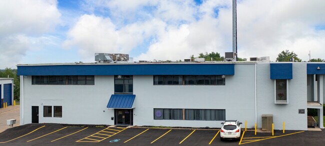
4095 Ferry Rd
34-011-033
5.762A N S LR09076 419 FT W US611 FERRY ROAD
Officebuilding
Bucks
C4
Pennsylvania
B and X Area of moderate flood hazard, usually the area between the limits of the 100-year and 500-year floods.
3.03 AC
2024
Upper Bucks County
2025
Philadelphia
104505
Philadelphia-Camden-Wilmington, PA-NJ-DE-MD
49,460 SF
NEARBY LISTINGS FOR SALE OR LEASE
DEMOGRAPHICS near 4095 Ferry Rd
1 mile
3 mile
5 mile
2025 Total Population
4,677
33,364
65,156
2030 Population
4,629
33,898
65,814
Pop Growth 2025-2030
(1.03%)
+ 1.60%
+ 1.01%
Average Age
40
44
44
2025 Total Households
1,661
13,154
24,753
HH Growth 2025-2030
(1.08%)
+ 2.11%
+ 1.32%
Median Household Inc
$120,913
$122,097
$130,066
Avg Household Size
2.80
2.50
2.50
2025 Avg HH Vehicles
2.00
2.00
2.00
Median Home Value
$599,249
$621,803
$640,560
Median Year Built
1994
1989
1983
Nearby Places
Map Layers
Map Styles
 Street
 Aerial
Transit
 Traffic
 Biking
Places
Listings with unknown addresses are not visible on the map
- Restaurants
- Banks
- Shops
- Fitness
- Groceries
PUBLIC TRANSPORTATION
COMMUTER RAIL
Doylestown (R5 - Southeastern Pennsylvania Transportation Authority Regional Rail (SEPTA Regional Rail))
Drive
Walk
Distance
Doylestown (R5 - Southeastern Pennsylvania Transportation Authority Regional Rail (SEPTA Regional Rail))
8 min
3.8 mi
Delaware Valley College (R5 - Southeastern Pennsylvania Transportation Authority Regional Rail (SEPTA Regional Rail))
Drive
Walk
Distance
Delaware Valley College (R5 - Southeastern Pennsylvania Transportation Authority Regional Rail (SEPTA Regional Rail))
8 min
4.7 mi
AIRPORT
Trenton Mercer
Drive
Walk
Distance
Trenton Mercer
40 min
24.0 mi
Lehigh Valley International
Drive
Walk
Distance
Lehigh Valley International
58 min
33.4 mi
Freight Ports
Port of Philadelphia
Drive
Walk
Distance
Port of Philadelphia
52 min
29.0 mi
SALE & LEASE HISTORY
LISTING DATE
SALE/LEASE

Sep 24, 2016
For Lease
May 15, 2023
For Lease
Jul 15, 2021
For Lease
Nearby Properties
Address
Land Use
TOTAL SIZE
Lot Size
Zoning
Address
Land Use
TOTAL SIZE
Lot Size
Zoning
72,937 SF
42.19 AC
CR
Address
Land Use
TOTAL SIZE
Lot Size
Zoning
254,699 SF
22.06 AC
RC
Address
Land Use
TOTAL SIZE
Lot Size
Zoning
192,365 SF
30.81 AC
C2
Address
Land Use
TOTAL SIZE
Lot Size
Zoning
90,000 SF
7.25 AC
R2
Address
Land Use
TOTAL SIZE
Lot Size
Zoning
91,222 SF
13.75 AC
R2
Address
Land Use
TOTAL SIZE
Lot Size
Zoning
109,660 SF
9.81 AC
R3
Address
Land Use
TOTAL SIZE
Lot Size
Zoning
97,496 SF
12.67 AC
R3
Address
Land Use
TOTAL SIZE
Lot Size
Zoning
60,500 SF
5.90 AC
C2
Address
Land Use
TOTAL SIZE
Lot Size
Zoning
230,150 SF
12.10 AC
CR-H
Address
Land Use
TOTAL SIZE
Lot Size
Zoning
77,964 SF
9.79 AC
R3
Address
Land Use
TOTAL SIZE
Lot Size
Zoning
32,319 SF
7.30 AC
C1
Address
Land Use
TOTAL SIZE
Lot Size
Zoning
114,588 SF
0.82 AC
FC
Address
Land Use
TOTAL SIZE
Lot Size
Zoning
50,049 SF
5.45 AC
PC1
Address
Land Use
TOTAL SIZE
Lot Size
Zoning
16,828 SF
3.28 AC
R2
Address
Land Use
TOTAL SIZE
Lot Size
Zoning
515 SF
128.48 AC
R1
Address
Land Use
TOTAL SIZE
Lot Size
Zoning
66,008 SF
13.28 AC
C3
Address
Land Use
TOTAL SIZE
Lot Size
Zoning
32,298 SF
3.97 AC
R3
Address
Land Use
TOTAL SIZE
Lot Size
Zoning
25,479 SF
15.35 AC
I
Address
Land Use
TOTAL SIZE
Lot Size
Zoning
234,274 SF
24.12 AC
C4
Address
Land Use
TOTAL SIZE
Lot Size
Zoning
85,416 SF
4.30 AC
PC1
Address
Land Use
TOTAL SIZE
Lot Size
Zoning
34,068 SF
1.09 AC
R2
Address
Land Use
TOTAL SIZE
Lot Size
Zoning
15,336 SF
9.10 AC
R3
Address
Land Use
TOTAL SIZE
Lot Size
Zoning
190,326 SF
8.95 AC
C1
Address
Land Use
TOTAL SIZE
Lot Size
Zoning
45,953 SF
2.12 AC
C2
Address
Land Use
TOTAL SIZE
Lot Size
Zoning
27,042 SF
4.02 AC
C1
Address
Land Use
TOTAL SIZE
Lot Size
Zoning
7,200 SF
6.47 AC
LI
Address
Land Use
TOTAL SIZE
Lot Size
Zoning
2,000 SF
8.62 AC
PI
Address
Land Use
TOTAL SIZE
Lot Size
Zoning
19,348 SF
4.86 AC
I
Address
Land Use
TOTAL SIZE
Lot Size
Zoning
39,936 SF
3.13 AC
RC
Address
Land Use
TOTAL SIZE
Lot Size
Zoning
16,300 SF
1.54 AC
FC
The World's #1 Commercial Real Estate Marketplace
Connect with us
© 2026 CoStar Group
The information above has been obtained from sources believed reliable. While we do not doubt its accuracy we have not verified it and make no guarantee, warranty or representation about it. It is your responsibility to independently confirm its accuracy and completeness. Any projections, opinions, assumptions, or estimates used are for example only and do not represent the current or future performance of the property. The value of this transaction to you depends on tax and other factors which should be evaluated by your tax, financial, and legal advisors. You and your advisors should conduct a careful, independent investigation of the property to determine to your satisfaction the suitability of the property for your needs.