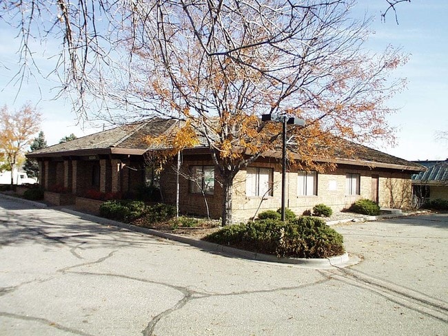
Property Record
4890 Kipling St, Wheat Ridge, CO 80033


Property Detail
4890 Kipling St
39-153-00-013
SECTION 15 TOWNSHIP 03 RANGE 69 QTR SW SIZE: 22015 VALUE: .505 KEY=044
Commercialnec
JEFFERSON
B and X Area of moderate flood hazard, usually the area between the limits of the 100-year and 500-year floods.
Colorado
0
0.51 AC
2025
Northwest Denver
010402
Denver
4,966 SF
Denver-Aurora-Centennial, CO
NEARBY LISTINGS FOR SALE OR LEASE
DEMOGRAPHICS near 4890 Kipling St
1 mile
3 mile
5 mile
2025 Total Population
12,793
103,111
286,681
2030 Population
12,910
103,208
287,961
Pop Growth 2025-2030
+ 0.91%
+ 0.09%
+ 0.45%
Average Age
40
42
41
2025 Total Households
5,819
44,914
122,414
HH Growth 2025-2030
+ 0.76%
+ 0.05%
+ 0.48%
Median Household Inc
$85,535
$93,050
$96,286
Avg Household Size
2.10
2.20
2.30
2025 Avg HH Vehicles
2.00
2.00
2.00
Median Home Value
$530,276
$683,281
$690,645
Median Year Built
1977
1971
1973
Nearby Places
Map Layers
Map Styles
 Street
 Aerial
Transit
 Traffic
 Biking
Places
Listings with unknown addresses are not visible on the map
- Restaurants
- Banks
- Shops
- Fitness
- Groceries
PUBLIC TRANSPORTATION
COMMUTER RAIL
Drive
Walk
Distance
3 min
12 min
0.6 mi
Drive
Walk
Distance
3 min
14 min
0.7 mi
AIRPORT
Denver International
Drive
Walk
Distance
Denver International
38 min
29.2 mi
SALE & LEASE HISTORY
LISTING DATE
SALE/LEASE

May 21, 2019
For Lease
May 08, 2019
For Lease
May 08, 2019
For Lease
May 08, 2019
For Sale
Jun 16, 2020
For Lease
Nearby Properties
Address
Land Use
TOTAL SIZE
Lot Size
Zoning
Address
Land Use
TOTAL SIZE
Lot Size
Zoning
830,160 SF
26.93 AC
Address
Land Use
TOTAL SIZE
Lot Size
Zoning
61,026 SF
2.81 AC
Address
Land Use
TOTAL SIZE
Lot Size
Zoning
88,507 SF
5.53 AC
Address
Land Use
TOTAL SIZE
Lot Size
Zoning
80,030 SF
2.25 AC
Address
Land Use
TOTAL SIZE
Lot Size
Zoning
103,174 SF
1.23 AC
Address
Land Use
TOTAL SIZE
Lot Size
Zoning
93,699 SF
1.89 AC
Address
Land Use
TOTAL SIZE
Lot Size
Zoning
56,930 SF
7.59 AC
Address
Land Use
TOTAL SIZE
Lot Size
Zoning
97,944 SF
6.34 AC
Address
Land Use
TOTAL SIZE
Lot Size
Zoning
56,854 SF
1.83 AC
Address
Land Use
TOTAL SIZE
Lot Size
Zoning
72,252 SF
4.20 AC
Address
Land Use
TOTAL SIZE
Lot Size
Zoning
49,337 SF
4.02 AC
Address
Land Use
TOTAL SIZE
Lot Size
Zoning
51,612 SF
1.76 AC
Address
Land Use
TOTAL SIZE
Lot Size
Zoning
50,490 SF
1.58 AC
Address
Land Use
TOTAL SIZE
Lot Size
Zoning
72,630 SF
5.08 AC
Address
Land Use
TOTAL SIZE
Lot Size
Zoning
53,503 SF
2.35 AC
Address
Land Use
TOTAL SIZE
Lot Size
Zoning
298,366 SF
24.21 AC
Address
Land Use
TOTAL SIZE
Lot Size
Zoning
59,824 SF
0.96 AC
Address
Land Use
TOTAL SIZE
Lot Size
Zoning
37,368 SF
0.87 AC
Address
Land Use
TOTAL SIZE
Lot Size
Zoning
42,474 SF
1.16 AC
Address
Land Use
TOTAL SIZE
Lot Size
Zoning
269,013 SF
31.89 AC
Address
Land Use
TOTAL SIZE
Lot Size
Zoning
48,252 SF
1.83 AC
Address
Land Use
TOTAL SIZE
Lot Size
Zoning
36,937 SF
0.88 AC
Address
Land Use
TOTAL SIZE
Lot Size
Zoning
125,610 SF
14.60 AC
Address
Land Use
TOTAL SIZE
Lot Size
Zoning
40,163 SF
5.46 AC
Address
Land Use
TOTAL SIZE
Lot Size
Zoning
48,225 SF
1.81 AC
Address
Land Use
TOTAL SIZE
Lot Size
Zoning
187,745 SF
16.25 AC
Address
Land Use
TOTAL SIZE
Lot Size
Zoning
187,095 SF
23.42 AC
Address
Land Use
TOTAL SIZE
Lot Size
Zoning
54,566 SF
1.39 AC
Address
Land Use
TOTAL SIZE
Lot Size
Zoning
436,238 SF
13.94 AC
Address
Land Use
TOTAL SIZE
Lot Size
Zoning
32,892 SF
1.82 AC
The World's #1 Commercial Real Estate Marketplace
Connect with us
© 2026 CoStar Group
The information above has been obtained from sources believed reliable. While we do not doubt its accuracy we have not verified it and make no guarantee, warranty or representation about it. It is your responsibility to independently confirm its accuracy and completeness. Any projections, opinions, assumptions, or estimates used are for example only and do not represent the current or future performance of the property. The value of this transaction to you depends on tax and other factors which should be evaluated by your tax, financial, and legal advisors. You and your advisors should conduct a careful, independent investigation of the property to determine to your satisfaction the suitability of the property for your needs.