Property Record
6700 Bird Rd, Miami, FL 33155
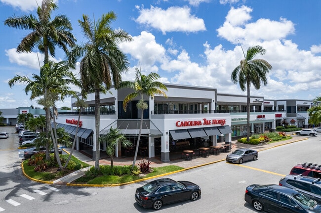


Property Detail
6700 Bird Rd
30-4023-072-0010
BIRD/LUDLUM PB 131-67 TR A & BEG 335FTS OF NE COR OF NW1/4 OF NE1/4 OF NE1/4 CONT S150FT W333.91FT N150FT E333.78FT TO POB LOT SIZE 682417 SQ FT OR 16475-2742 2744 0894 1 & OR 17130-0188 0192 6
Regionalshoppingcenterormallwithanchorstore
Miami-Dade
6400
Florida
AH Areas with a 1% annual chance of shallow flooding, usually in the form of a pond, withan average depth ranging from 1 to 3 feet. These areas have a 26% chance of flooding over the life of a 30-year mortgage.
15.67 AC
2024
West Miami
2025
South Florida
007605
Miami-Miami Beach-Kendall, FL
212,145 SF
NEARBY LISTINGS FOR SALE OR LEASE
DEMOGRAPHICS near 6700 Bird Rd
1 mile
3 mile
5 mile
2025 Total Population
15,891
165,106
465,279
2030 Population
16,983
175,833
496,531
Pop Growth 2025-2030
+ 6.87%
+ 6.50%
+ 6.72%
Average Age
44
43
43
2025 Total Households
6,106
61,150
174,294
HH Growth 2025-2030
+ 7.01%
+ 6.73%
+ 6.90%
Median Household Inc
$94,199
$93,124
$80,780
Avg Household Size
2.50
2.60
2.60
2025 Avg HH Vehicles
2.00
2.00
2.00
Median Home Value
$662,614
$714,685
$632,821
Median Year Built
1963
1964
1973
Nearby Places
Map Layers
Map Styles
 Street
 Aerial
Layers
 Traffic
 Biking
Places
Listings with unknown addresses are not visible on the map
- Restaurants
- Banks
- Shops
- Fitness
- Groceries
PUBLIC TRANSPORTATION
COMMUTER RAIL
South Miami (Metrorail Green Line - Miami-Dade Transit (Metrorail/Metromover))
Drive
Walk
Distance
South Miami (Metrorail Green Line - Miami-Dade Transit (Metrorail/Metromover))
6 min
3.2 mi
University (Metrorail Green Line - Miami-Dade Transit (Metrorail/Metromover))
Drive
Walk
Distance
University (Metrorail Green Line - Miami-Dade Transit (Metrorail/Metromover))
7 min
3.4 mi
AIRPORT
Miami International
Drive
Walk
Distance
Miami International
16 min
7.8 mi
Fort Lauderdale/Hollywood International
Drive
Walk
Distance
Fort Lauderdale/Hollywood International
47 min
31.1 mi
Freight Ports
Port of Miami
Drive
Walk
Distance
Port of Miami
22 min
10.8 mi
SALE & LEASE HISTORY
LISTING DATE
SALE/LEASE

Sep 25, 2016
For Lease
May 30, 2017
For Lease
May 10, 2021
For Lease
May 10, 2021
For Lease
Mar 10, 2017
For Lease
Jul 24, 2017
For Lease
Nearby Properties
Address
Land Use
TOTAL SIZE
Lot Size
Zoning
Address
Land Use
TOTAL SIZE
Lot Size
Zoning
883,561 SF
5.63 AC
8200
Address
Land Use
TOTAL SIZE
Lot Size
Zoning
1,647,481 SF
23.04 AC
5000
Address
Land Use
TOTAL SIZE
Lot Size
Zoning
877,136 SF
2.96 AC
6112
Address
Land Use
TOTAL SIZE
Lot Size
Zoning
715,755 SF
2.66 AC
5005
Address
Land Use
TOTAL SIZE
Lot Size
Zoning
973,728 SF
76.18 AC
8200
Address
Land Use
TOTAL SIZE
Lot Size
Zoning
764,501 SF
1.81 AC
6114
Address
Land Use
TOTAL SIZE
Lot Size
Zoning
644,929 SF
1.10 AC
6114
Address
Land Use
TOTAL SIZE
Lot Size
Zoning
759,863 SF
7.02 AC
6506
Address
Land Use
TOTAL SIZE
Lot Size
Zoning
345,178 SF
6.73 AC
5005
Address
Land Use
TOTAL SIZE
Lot Size
Zoning
1,168,390 SF
0.04 AC
7100
Address
Land Use
TOTAL SIZE
Lot Size
Zoning
423,104 SF
2.58 AC
6200
Address
Land Use
TOTAL SIZE
Lot Size
Zoning
408,292 SF
0.88 AC
6110
Address
Land Use
TOTAL SIZE
Lot Size
Zoning
275,755 SF
6.73 AC
5005
Address
Land Use
TOTAL SIZE
Lot Size
Zoning
247,488 SF
4.25 AC
5005
Address
Land Use
TOTAL SIZE
Lot Size
Zoning
500,332 SF
3.46 AC
6000
Address
Land Use
TOTAL SIZE
Lot Size
Zoning
532,779 SF
0000
Address
Land Use
TOTAL SIZE
Lot Size
Zoning
365,003 SF
15.05 AC
8200
Address
Land Use
TOTAL SIZE
Lot Size
Zoning
431,941 SF
2.06 AC
6110
Address
Land Use
TOTAL SIZE
Lot Size
Zoning
535,679 SF
2.73 AC
6000
Address
Land Use
TOTAL SIZE
Lot Size
Zoning
668,569 SF
2.33 AC
5004
Address
Land Use
TOTAL SIZE
Lot Size
Zoning
449,572 SF
1.74 AC
6110
Address
Land Use
TOTAL SIZE
Lot Size
Zoning
14.30 AC
0700
Address
Land Use
TOTAL SIZE
Lot Size
Zoning
859,337 SF
0.13 AC
7100
Address
Land Use
TOTAL SIZE
Lot Size
Zoning
516,656 SF
9.65 AC
6300
Address
Land Use
TOTAL SIZE
Lot Size
Zoning
498,294 SF
1.19 AC
5005
Address
Land Use
TOTAL SIZE
Lot Size
Zoning
551,110 SF
1.33 AC
5005
Address
Land Use
TOTAL SIZE
Lot Size
Zoning
290,426 SF
1 AC
5004
Address
Land Use
TOTAL SIZE
Lot Size
Zoning
11.74 AC
5004
Address
Land Use
TOTAL SIZE
Lot Size
Zoning
364,114 SF
20 AC
3100
Address
Land Use
TOTAL SIZE
Lot Size
Zoning
432,416 SF
1.67 AC
5004
The World's #1 Commercial Real Estate Marketplace
Connect with us
© 2026 CoStar Group
The information above has been obtained from sources believed reliable. While we do not doubt its accuracy we have not verified it and make no guarantee, warranty or representation about it. It is your responsibility to independently confirm its accuracy and completeness. Any projections, opinions, assumptions, or estimates used are for example only and do not represent the current or future performance of the property. The value of this transaction to you depends on tax and other factors which should be evaluated by your tax, financial, and legal advisors. You and your advisors should conduct a careful, independent investigation of the property to determine to your satisfaction the suitability of the property for your needs.