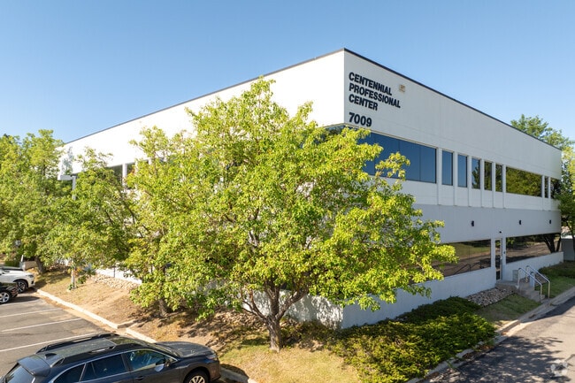
Property Record
7009 S Potomac St, Centennial, CO 80112


Current Lease Availabilities
Property Detail
7009 S Potomac St
2075-25-1-25-001
FILING NO 2
Officebuilding
Arapahoe
PUD
Colorado
B and X Area of moderate flood hazard, usually the area between the limits of the 100-year and 500-year floods.
1
2025
4.40 AC
2026
Centennial
006864
Denver
61,221 SF
Denver-Aurora-Centennial, CO
NEARBY LISTINGS FOR SALE OR LEASE
DEMOGRAPHICS near 7009 S Potomac St
1 mile
3 mile
5 mile
2025 Total Population
4,810
59,677
234,559
2030 Population
4,895
61,157
241,395
Pop Growth 2025-2030
+ 1.77%
+ 2.48%
+ 2.91%
Average Age
37
39
39
2025 Total Households
1,613
23,048
93,281
HH Growth 2025-2030
+ 1.61%
+ 2.84%
+ 3.29%
Median Household Inc
$97,072
$116,796
$113,537
Avg Household Size
2.40
2.50
2.40
2025 Avg HH Vehicles
2.00
2.00
2.00
Median Home Value
$620,141
$739,364
$676,125
Median Year Built
2003
2000
1994
Nearby Places
Map Layers
Map Styles
 Street
 Aerial
Layers
 Traffic
 Biking
Places
Listings with unknown addresses are not visible on the map
- Restaurants
- Banks
- Shops
- Fitness
- Groceries
PUBLIC TRANSPORTATION
AIRPORT
Denver International
Drive
Walk
Distance
Denver International
37 min
32.8 mi
Freight Ports
Tulsa Port Of Catoosa
Drive
Walk
Distance
Tulsa Port Of Catoosa
730 min
712.7 mi
Nearby Properties
Address
Land Use
TOTAL SIZE
Lot Size
Zoning
Address
Land Use
TOTAL SIZE
Lot Size
Zoning
709,725 SF
15.21 AC
Address
Land Use
TOTAL SIZE
Lot Size
Zoning
709,725 SF
29.14 AC
Address
Land Use
TOTAL SIZE
Lot Size
Zoning
280,586 SF
60.97 AC
RPD
Address
Land Use
TOTAL SIZE
Lot Size
Zoning
482,711 SF
26.15 AC
AMU
Address
Land Use
TOTAL SIZE
Lot Size
Zoning
637,459 SF
4.94 AC
AMU
Address
Land Use
TOTAL SIZE
Lot Size
Zoning
29,070 SF
308.89 AC
Address
Land Use
TOTAL SIZE
Lot Size
Zoning
1,210,850 SF
13.65 AC
AMU
Address
Land Use
TOTAL SIZE
Lot Size
Zoning
284,862 SF
23.37 AC
PUD
Address
Land Use
TOTAL SIZE
Lot Size
Zoning
305,198 SF
34.41 AC
PUD
Address
Land Use
TOTAL SIZE
Lot Size
Zoning
246,768 SF
12.37 AC
PUD
Address
Land Use
TOTAL SIZE
Lot Size
Zoning
134,316 SF
26.52 AC
Address
Land Use
TOTAL SIZE
Lot Size
Zoning
139,291 SF
8.63 AC
AMU
Address
Land Use
TOTAL SIZE
Lot Size
Zoning
Address
Land Use
TOTAL SIZE
Lot Size
Zoning
216,853 SF
5.42 AC
PUD
Address
Land Use
TOTAL SIZE
Lot Size
Zoning
231,715 SF
5.58 AC
Address
Land Use
TOTAL SIZE
Lot Size
Zoning
224,978 SF
18.99 AC
Address
Land Use
TOTAL SIZE
Lot Size
Zoning
304,620 SF
23.95 AC
AMU
Address
Land Use
TOTAL SIZE
Lot Size
Zoning
107,760 SF
5.41 AC
AMU
Address
Land Use
TOTAL SIZE
Lot Size
Zoning
279,884 SF
14.72 AC
Address
Land Use
TOTAL SIZE
Lot Size
Zoning
441,689 SF
25.31 AC
Address
Land Use
TOTAL SIZE
Lot Size
Zoning
222,000 SF
16.26 AC
AMU
Address
Land Use
TOTAL SIZE
Lot Size
Zoning
355,326 SF
12.27 AC
PUD
Address
Land Use
TOTAL SIZE
Lot Size
Zoning
253,296 SF
16.41 AC
Address
Land Use
TOTAL SIZE
Lot Size
Zoning
222,931 SF
13 AC
Address
Land Use
TOTAL SIZE
Lot Size
Zoning
36.87 AC
Address
Land Use
TOTAL SIZE
Lot Size
Zoning
281,429 SF
22.55 AC
PUD
Address
Land Use
TOTAL SIZE
Lot Size
Zoning
217,273 SF
18.28 AC
Address
Land Use
TOTAL SIZE
Lot Size
Zoning
171,600 SF
10.32 AC
AA2
Address
Land Use
TOTAL SIZE
Lot Size
Zoning
195,390 SF
14.78 AC
AI1
Address
Land Use
TOTAL SIZE
Lot Size
Zoning
326,230 SF
9.69 AC
The World's #1 Commercial Real Estate Marketplace
Connect with us
© 2026 CoStar Group
The information above has been obtained from sources believed reliable. While we do not doubt its accuracy we have not verified it and make no guarantee, warranty or representation about it. It is your responsibility to independently confirm its accuracy and completeness. Any projections, opinions, assumptions, or estimates used are for example only and do not represent the current or future performance of the property. The value of this transaction to you depends on tax and other factors which should be evaluated by your tax, financial, and legal advisors. You and your advisors should conduct a careful, independent investigation of the property to determine to your satisfaction the suitability of the property for your needs.