Property Record
1717 S Decatur Blvd, Las Vegas, NV 89102
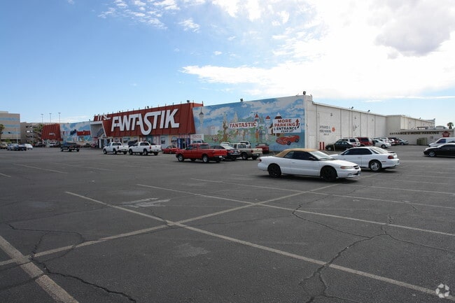

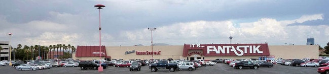
Property Detail
1717 S Decatur Blvd
162-06-301-002
PARCEL MAP FILE 34 PAGE 87 LOT 2
Storebuilding
Clark
C1
Nevada
B and X Area of moderate flood hazard, usually the area between the limits of the 100-year and 500-year floods.
2
2026
15.23 AC
2026
Central West Las Vegas
001004
Las Vegas
179,051 SF
Las Vegas-Henderson-North Las Vegas, NV
NEARBY LISTINGS FOR SALE OR LEASE
DEMOGRAPHICS near 1717 S Decatur Blvd
1 mile
3 mile
5 mile
2025 Total Population
22,830
179,277
498,863
2030 Population
24,038
189,749
525,091
Pop Growth 2025-2030
+ 5.29%
+ 5.84%
+ 5.26%
Average Age
40
40
40
2025 Total Households
8,587
69,291
199,626
HH Growth 2025-2030
+ 5.40%
+ 6.06%
+ 5.38%
Median Household Inc
$57,197
$57,207
$56,715
Avg Household Size
2.50
2.50
2.40
2025 Avg HH Vehicles
1.00
1.00
1.00
Median Home Value
$359,259
$371,788
$374,202
Median Year Built
1978
1981
1986
Nearby Places
Map Layers
Map Styles
 Street
 Aerial
Layers
 Traffic
 Biking
Places
Listings with unknown addresses are not visible on the map
- Restaurants
- Banks
- Shops
- Fitness
- Groceries
PUBLIC TRANSPORTATION
AIRPORT
Harry Reid International
Drive
Walk
Distance
Harry Reid International
16 min
7.5 mi
Boulder City Municipal
Drive
Walk
Distance
Boulder City Municipal
41 min
28.4 mi
Freight Ports
Port of Long Beach
Drive
Walk
Distance
Port of Long Beach
318 min
282.9 mi
SALE & LEASE HISTORY
LISTING DATE
SALE/LEASE

Sep 26, 2016
For Lease
Nearby Properties
Address
Land Use
TOTAL SIZE
Lot Size
Zoning
Address
Land Use
TOTAL SIZE
Lot Size
Zoning
3,693,440 SF
43.59 AC
Address
Land Use
TOTAL SIZE
Lot Size
Zoning
3,391,505 SF
68.52 AC
Address
Land Use
TOTAL SIZE
Lot Size
Zoning
3,391,505 SF
68.55 AC
Address
Land Use
TOTAL SIZE
Lot Size
Zoning
1,172,527 SF
19.67 AC
H1
Address
Land Use
TOTAL SIZE
Lot Size
Zoning
1,044,724 SF
56.56 AC
Address
Land Use
TOTAL SIZE
Lot Size
Zoning
8,805 SF
45.63 AC
Address
Land Use
TOTAL SIZE
Lot Size
Zoning
1,447,338 SF
65.25 AC
H1
Address
Land Use
TOTAL SIZE
Lot Size
Zoning
248,689 SF
19.45 AC
H1
Address
Land Use
TOTAL SIZE
Lot Size
Zoning
659,669 SF
24.79 AC
H1
Address
Land Use
TOTAL SIZE
Lot Size
Zoning
1,069,498 SF
28.36 AC
H1
Address
Land Use
TOTAL SIZE
Lot Size
Zoning
497,331 SF
24.44 AC
Address
Land Use
TOTAL SIZE
Lot Size
Zoning
987,719 SF
12.98 AC
H1
Address
Land Use
TOTAL SIZE
Lot Size
Zoning
162,214 SF
4.32 AC
Address
Land Use
TOTAL SIZE
Lot Size
Zoning
34,354 SF
33.06 AC
Address
Land Use
TOTAL SIZE
Lot Size
Zoning
115,059 SF
30.12 AC
Address
Land Use
TOTAL SIZE
Lot Size
Zoning
20,924 SF
17.50 AC
H1
Address
Land Use
TOTAL SIZE
Lot Size
Zoning
740,584 SF
0.98 AC
Address
Land Use
TOTAL SIZE
Lot Size
Zoning
611,832 SF
10 AC
Address
Land Use
TOTAL SIZE
Lot Size
Zoning
24,965 SF
25.75 AC
Address
Land Use
TOTAL SIZE
Lot Size
Zoning
1,283,663 SF
8.56 AC
PD
Address
Land Use
TOTAL SIZE
Lot Size
Zoning
962,611 SF
28.43 AC
Address
Land Use
TOTAL SIZE
Lot Size
Zoning
80.45 AC
CV
Address
Land Use
TOTAL SIZE
Lot Size
Zoning
573,491 SF
38.94 AC
Address
Land Use
TOTAL SIZE
Lot Size
Zoning
109,306 SF
25.79 AC
H1
Address
Land Use
TOTAL SIZE
Lot Size
Zoning
34.83 AC
CV
Address
Land Use
TOTAL SIZE
Lot Size
Zoning
814,789 SF
13.75 AC
C1
Address
Land Use
TOTAL SIZE
Lot Size
Zoning
20.21 AC
H1
Address
Land Use
TOTAL SIZE
Lot Size
Zoning
257,182 SF
4 AC
Address
Land Use
TOTAL SIZE
Lot Size
Zoning
7,630 SF
12.71 AC
H1
The World's #1 Commercial Real Estate Marketplace
Connect with us
© 2026 CoStar Group
The information above has been obtained from sources believed reliable. While we do not doubt its accuracy we have not verified it and make no guarantee, warranty or representation about it. It is your responsibility to independently confirm its accuracy and completeness. Any projections, opinions, assumptions, or estimates used are for example only and do not represent the current or future performance of the property. The value of this transaction to you depends on tax and other factors which should be evaluated by your tax, financial, and legal advisors. You and your advisors should conduct a careful, independent investigation of the property to determine to your satisfaction the suitability of the property for your needs.